As precision agriculture becomes a standard, Earlybird Aerial Services strives to be on the cutting edge. We now have the capability to create management zones based on soil type, topography, and drainage with Color Infrared Imaging. Sand, silt and clay along with organic matter and the water content of the soil each reflect infrared light differently.
In the past, we have had to rely on USDA soil type lines and grid soil sampling to generate management zones and VRT recommendations. Given the available technology in the 1970’s, these maps have provided us with valuable information but as equipment has evolved, we have long surpassed the accuracy they can provide. We now have the capability to manage the variability of each field at a sub 6” level.
Each image is geo-referenced and applications include soil testing by soil zone and VRT applications of lime, fertility and seed. Our confidence stems from multiple years of research and strong correlations between our zones and soil test results including CEC and organic matter. This method has allowed us to overcome the variability in a standard grid soil testing program. We service local producers and progressive dealers scattered across the Midwest.
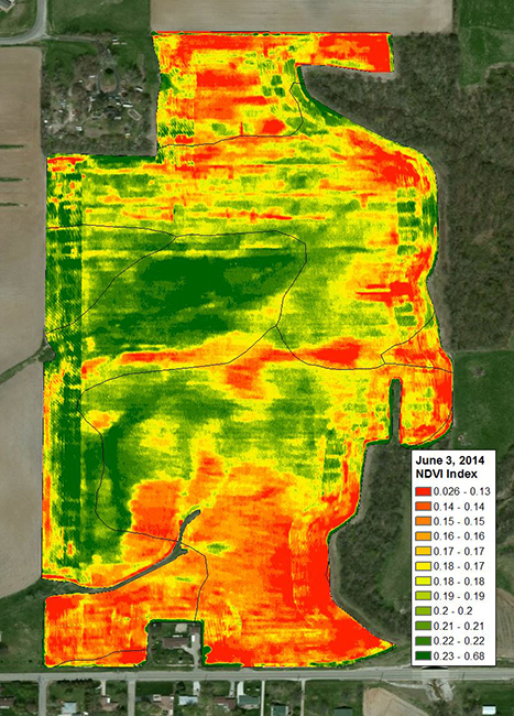
We utilize extensive crop scouting in order to make the most informed decisions for our growers. Part of scouting service we offer is the use of NDVI’s. Using the same camera technology, we take in-crop images in order to detect crop stress that is not visible to the naked eye. Each image is then processed into a geo-referenced NDVI map of that field. Our crop scouts or the growers themselves can take this NDVI map into the field and walk directly to the areas of concern.